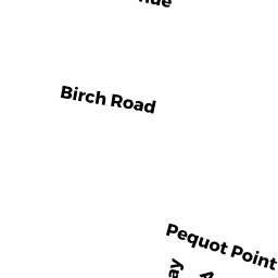
0 PEQUOT POINT RD
Owner Information
SPENCER DAVID J. & LINDA C.
97 PEQUOT POINT RD
WESTFIELD, MA 01085


Property Details
0 PEQUOT POINT RD is classified as a Single Family Residential (Conventional).
The primary structure on this property was built in 1940. There are 2,538ft2 of built area within this property. This property is listed as having 5 rooms.
0 PEQUOT POINT RD is valued at $156,400. The land is valued at $73,100 and the structures are valued at $83,300.
This property is in Zone RA. Confirm with local Zoning Board authorities to ensure there are no overlays or other easements on this property.
The most recent deed for 0 PEQUOT POINT RD is recorded at the local registrar in Book 4599, Page 83. 0 PEQUOT POINT RD was last sold on Thursday, June 1, 1978 for $2.
Assessment data from fiscal year 2019.
Flood Data
According to the FEMA National Flood Hazard Layer, this property does not appear to be in a flood zone. It may also be in an area not yet reviewed. Nonetheless, confirm this information prior to taking any action.
To view the flood hazards around this property, create a FEMA "Firmette" Map of the area around 0 PEQUOT POINT RD.
Broadband Internet Providers
| Provider | Type | Bandwidth (mbps) | |
|---|---|---|---|
| GCI Communication Corp. | Satellite | 0 | 0 |
| Viasat Inc | Satellite | 100 | 3 |
| Verizon New England Inc. | DSL | 3 | 0 |
| VSAT Systems, LLC. | Satellite | 2 | 1 |
| HughesNet | Satellite | 25 | 3 |
| Comcast | Cable | 1000 | 35 |
Broadband service provider data from December 2020.
Adjacent Properties
- 248 BIRCH RD
Single Family Residential owned by KENNEY, JACQUELYN M & EDWARD J - 0 PEQUOT POINT RD
Undevelopable Residential Land owned by SPENCER DAVID + LINDA - 4 PEQUOT POINT RD
Two-Family Residential owned by EMERSON, WILLIAM E & SALLY - 15 BIRCH RD
Single Family Residential owned by KOZIKOWSKI LEE J. & LORI-ANN